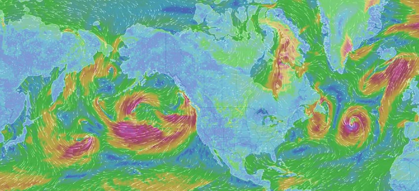
A world of weather in 2013!
This is the fantastic video that shows the weather of the world in during 2013!
An incredible video-clip!
The weather of the world in four minutes!!!

Climatologist/Glaciologist/GIS analyst with excellent skills in Big Data management and Spatial Data analysis with Python and GIS software


A world of weather in 2013!
This is the fantastic video that shows the weather of the world in during 2013!
An incredible video-clip!

Was presented the report of 2013 by the IPCC(’Intergovernmental Panel for Climate Change)
The results of this study,fruit of work of more than one hundred scientist from all over the world is clearer:the global temperature continues to increase and the activities of the man is responsible of this.
The global temperature from 1870 was increase about 0,78°C.
The last three decades were the more hot than the older decades.

The glaciers every year are losing mass and the ice cover of Artide is decreasing.
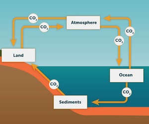
The key element of this increase of temperature is the CO2 that increase over the 40% compared to 1750!
It’s probabily that the human activities were the cause of at least of half increase of global temperature.
From 1750 to 2011 the antropogenic emissions have released about 545Giga Ton of CO in the atmosphere!
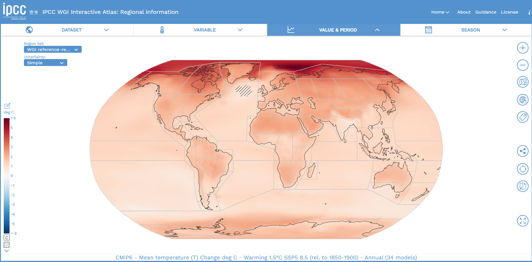
The projections for the future based on matematicals models shows another increase of global warming in many region of the world.
To stop this phenomenon is important that now are taken quickly restrictive measure about the CO2 emissions!

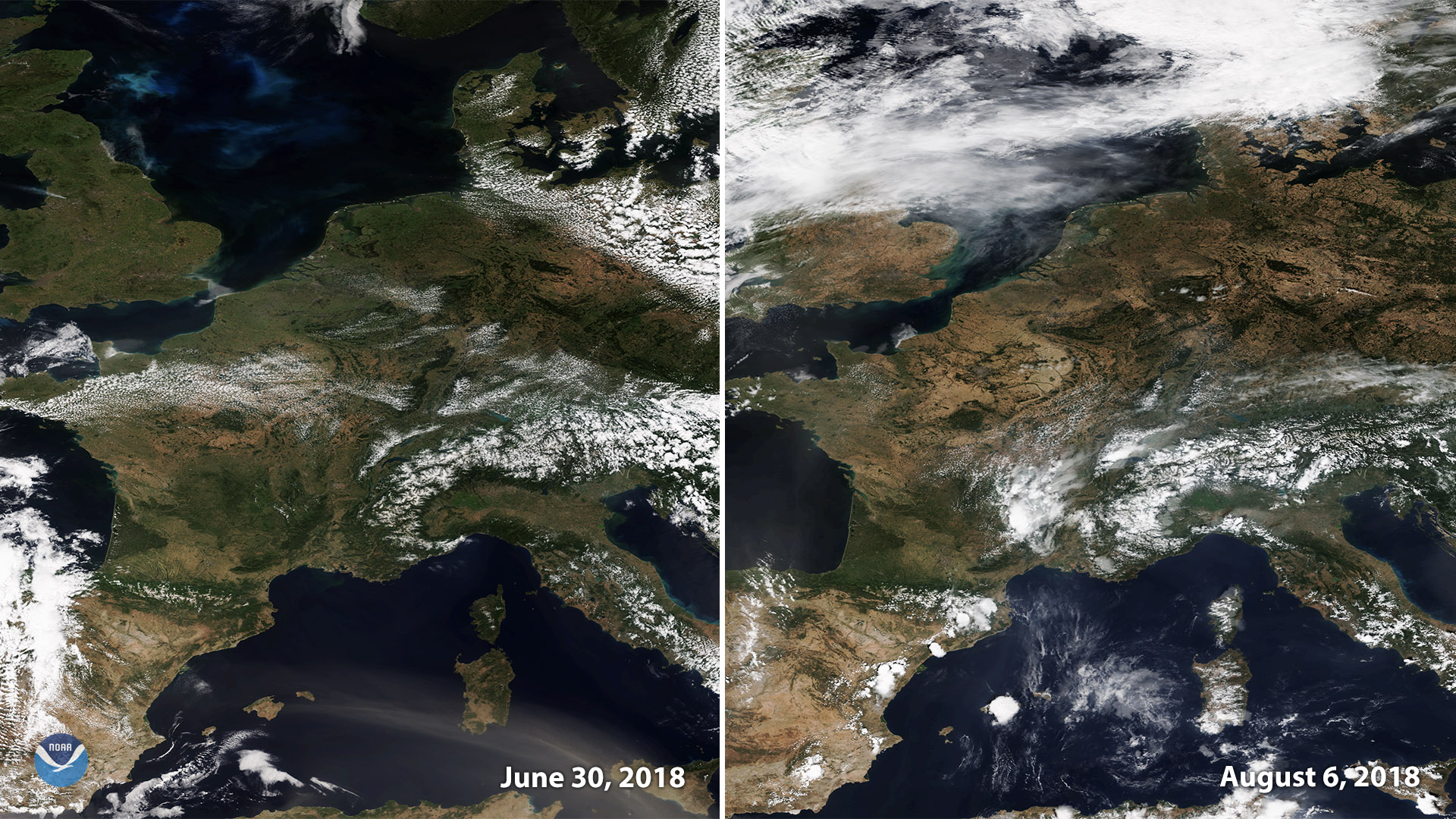
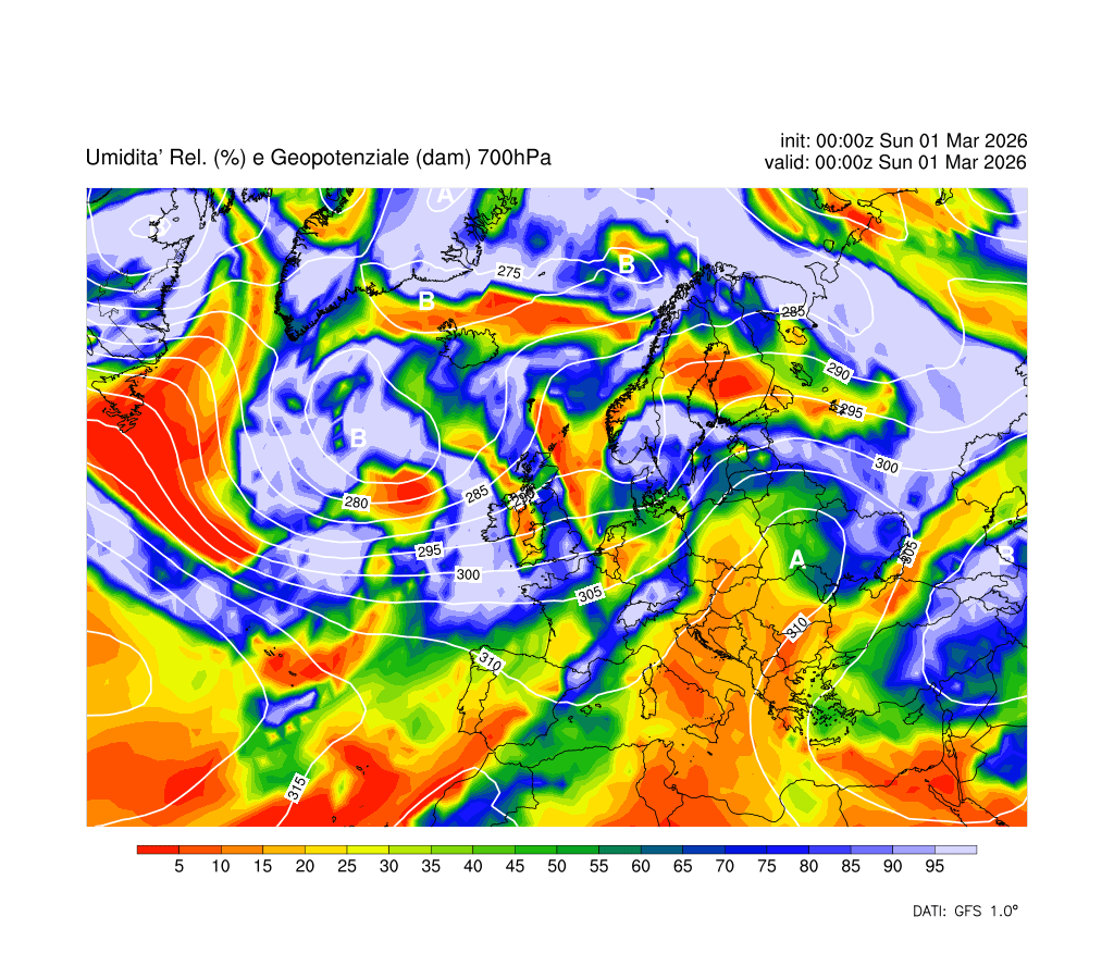
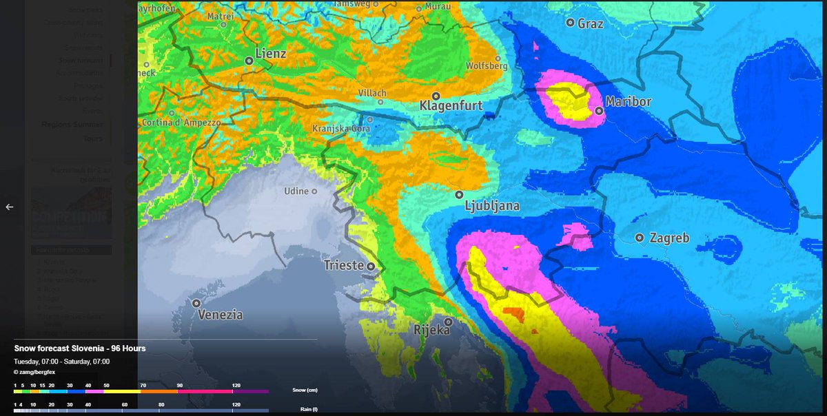
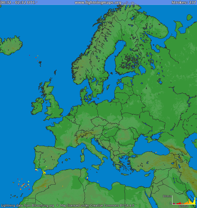
In arrivo aria piuttosto fredda dal nord europa
A partire da giovedì sera comincerà ad affluire da nord aria decisamente più fredda di estrazione artica.
Nonostante il grosso del freddo rimarrà confinato al di la delle Alpi, percepiremo comunque un sensibile calo delle temperature.
Nella giornata di giovedì comincerà l’avanzata del nucleo freddo verso il nord Italia che porterà le prime nevicate sulle alpi e forti temporali in pianura per il grande contrasto termico che si verrà a creare sul nostro territorio.

Nucleo gelido ben visibile che invade l’europa centrale e parte della nostra penisola nella notte di venerdì
Venerdì mattina farà molto fresco
Si prevedono temperature sotto i 10 gradi centigradi nella mattinata di venerdì.per il resto cielo sereno anche se per tutta la giornata la ventilazione rimarrà proveniente da nord.
Sabato in arrivo nuova perturbazione
In arrivo un’ulteriore debole perturbazione che porterà piovaschi e un debole rialzo termico.
Lo scenario non è previsto in mutazione per la giornata di Domenica che si prevede uguale a quella precedente.

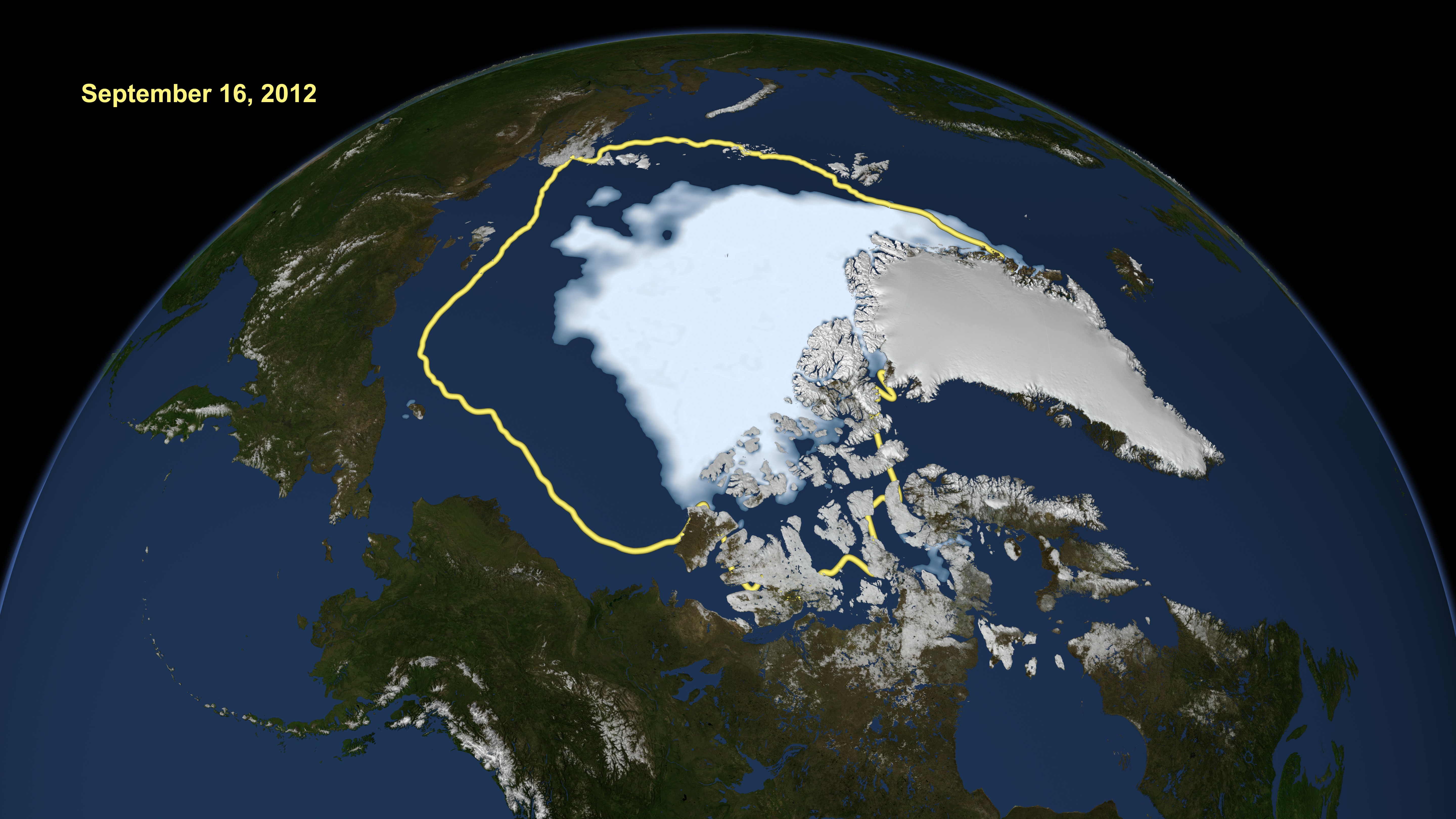
Very cool summer allowed the ice of the North Pole to melt less than in years past, and especially compared to the disastrous 2012. Meanwhile, in the Antarctic, sea ice reached the highest extent recorded in the satellite record.

Meanwhile, in the Antarctic, sea ice reached the highest extent recorded in the satellite record.
In 2013 year the Ice loss slowed down in August to only a little faster than average rates of loss for that time of year. In comparison, during 2012, the rate of loss accelerated in early June and through July, then accelerated even more in August to produce a new record low extent in September 2012.

The graph above shows Arctic sea ice extent as of September 30, 2013, along with daily ice extent data for the previous five years. 2013 is shown in light blue, 2012 in green, 2011 in orange, 2010 in light purple, 2009 in dark blue, and 2008 in dark purple.
This year was notably different than 2012. Because this year’s wind pattern was different than 2012, the multiyear ice largely remained in a compact area along the Canadian Archipelago and did not circulate into the Beaufort and Chukchi seas. The cooler conditions this summer also helped preserve more of the first-year ice through the summer.

These images from March 2013 (top) and September 2013 (bottom) show the changes in multiyear ice between this year’s sea ice maximum and minimum extents. In contrast to 2012, the record low extent year, multiyear ice tended to stay put, rather than being circulated around, which can expose it to warmer currents and winds that increase melt. Much of the Arctic ice cover now consists of first-year ice (shown in purple), which tends to melt rapidly in summer’s warmth.
Antarctic sea ice extent reached 19.47 million square kilometers (7.52 million square miles) on September 22, a record high maximum extent relative to the satellite record, and slightly above the previous record high set last year.

Antarctic sea ice extent for September 2013 was 19.77 million square kilometers (7.63 million square miles). The magenta line shows the 1981 to 2010 median extent for that month.


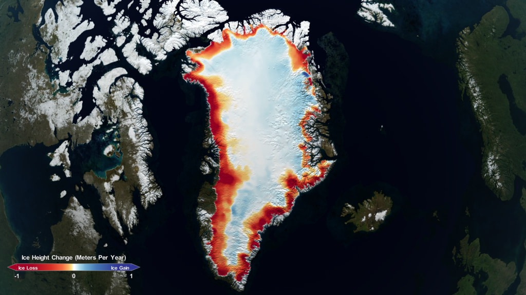
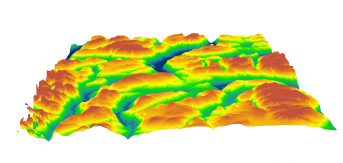
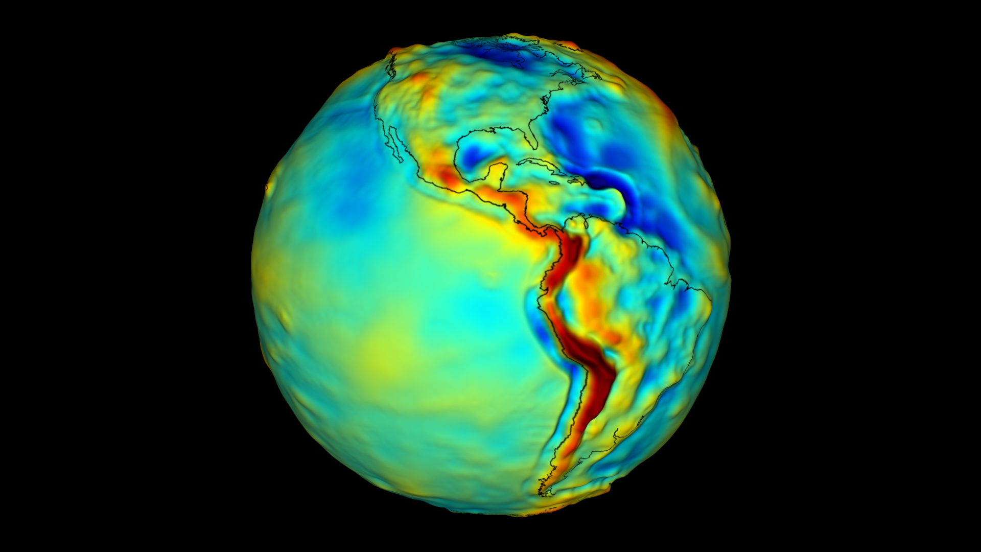
The glaciers of Greenland are continually losing volume and extension.
But now the cause is not only of the global warming!
In fact, according to a recent study published on nature geoscience carried by an international researchers group,the ice does not melt only above but also from below from the heat of the earth in this region.
About the data collected the glacier-cap decreases every years even 227 tonn/years,
This discovery will have an important role in the future,specially into the prediction of climate models.

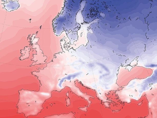
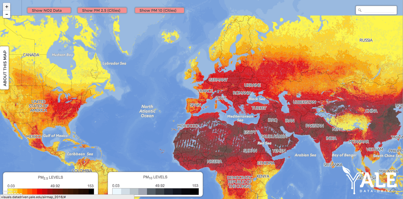
Emisfero nord molto caldo
Luglio 2013 secondo il dati di temperatura combinata dell’agenzia statunitense NOAA (National Oceanic and Atmospheric Administration) è stato il sesto più caldo di sempre da quando esistono le registrazioni e cioè dal 1880 con un valore che si attesta intorno ai 16.5°C, 0,61° al di sopra della media mensile dell’ultimo secolo.
Record no,ma la terra è molto calda!
Oltre a ciò è stato il 341/o mese consecutivo con temperatura globale al di sopra della media del ventesimo secolo.
Come possiamo vedere dall’immagine NOAA i luoghi maggiormente interessati da anomalie positive di temperatura nell’emisfero boreale sono stati il giappone l’europa centrale la russia più settentrionale i territorii dell’est e ovest degli stati uniti e parte dell’alaska occidentale.
E l’emisfero australe?
Per quanto riguarda l’emisfero australe si può notare come luglio si stato sopra media anche su tutta l’australia classificandosi come il quarto più caldo dall’inizio delle registrazioni dopo aver vissuto nei mesi precedenti l’estate meteorologica più calda che il paese ricordi.
Anche in nuova zelanda il mese si è posizionato al quarto posto tra quelli più caldi.