
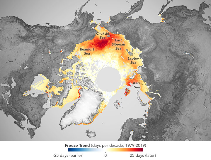
Here it’s my last raw release with QGIS. The aim of this work is to identify the structures subject to flooding risk in Oslo, Norway. Everything was done with the use of an intersection geoprocessing tool between two shapefiles.

Climatologist/Glaciologist/GIS analyst with excellent skills in Big Data management and Spatial Data analysis with Python and GIS software


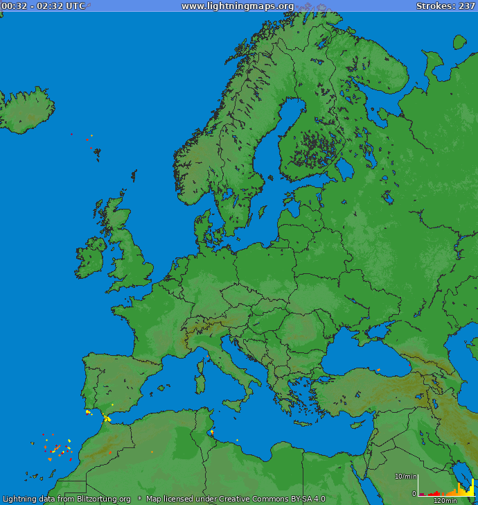


Here it’s my last raw release with QGIS. The aim of this work is to identify the structures subject to flooding risk in Oslo, Norway. Everything was done with the use of an intersection geoprocessing tool between two shapefiles.
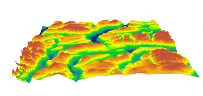
This is my release. A little exemple of a Digital Elevation Model with isolines of an area near Garda Lake (North Italy). I exctracted this DEM from Google Earth Application. I hope you enjoy it!

ICELAND DIGITAL ELEVATION MAP
I’m so proud to announce my last release with Qgis software. A digital elevation map of Iceland with a clear legend. I hope you will like it! For more info don’t have problems to contact me

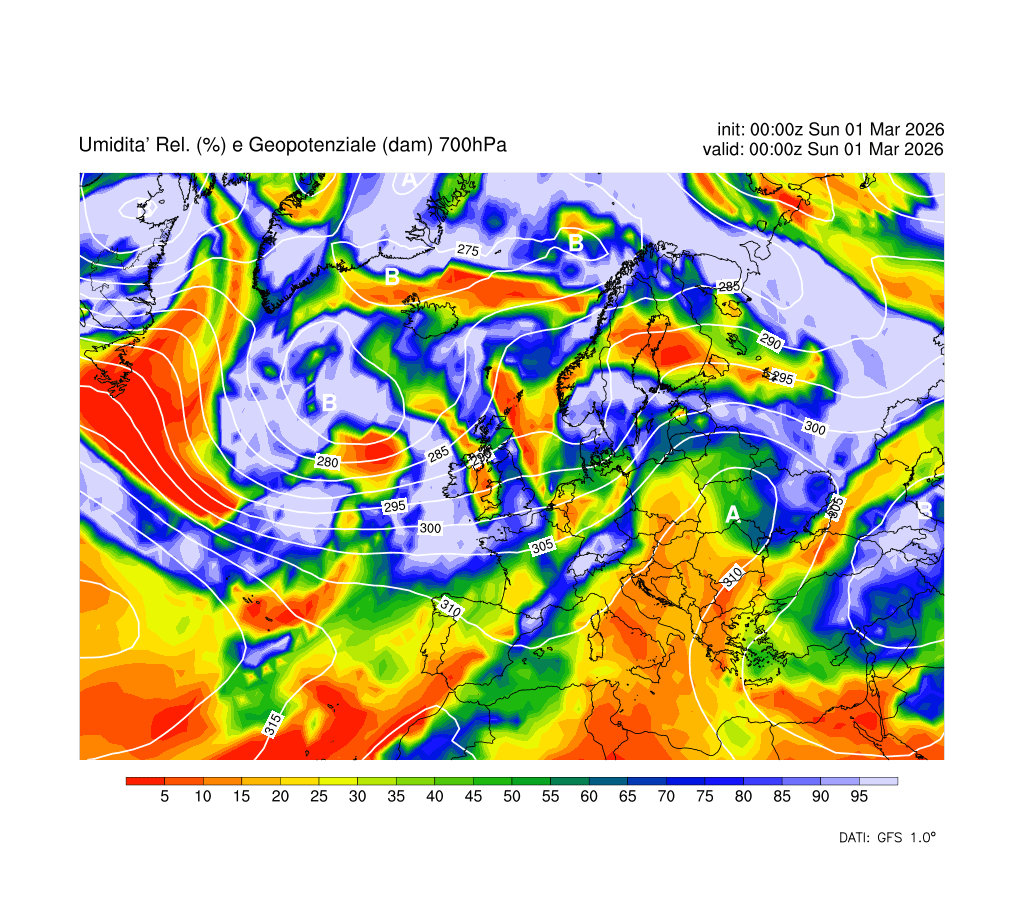
Here my last release. An image with legend describes the Pianura Padana and Alps land cover. The main cover of Pianura Padana is for the crops, while the forest and perpetual-semiperpetual snow area characterize the main cover of Alps. https://meteomaffezzoni.wordpress.com/wp-content/uploads/2016/09/crops.jpeg?w=1462


